Dispossesions in the Americas

Dispossesions in the Americas

  • Inicio
  • Explorar
  • Autores
  • Sobre
  • Arte
  • Cuerpos
  • Planes de Estudio
  • Herencia Cultural
  • Mapas
  • Territorios
Volver a Explorar

Leyendo en Inglés

Mapa 1735

The Spanish and Musketor shore and the bay of Honduras and the islands adjacent

  • Samuel Penhallon

Publicado: 1735

  • Descargar Imágen
  • Descargar Imágen
Mapa 1735

The Spanish and Musketor shore and the bay of Honduras and the islands adjacent

  • Samuel Penhallon

Publicado: 1735

  • Descargar Imágen

Pueblos

  • INDIAN

Citas

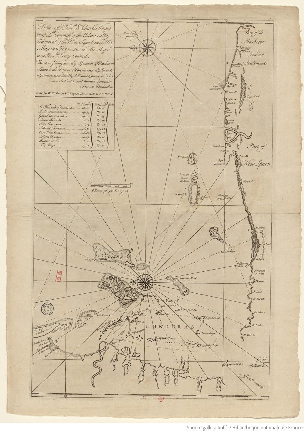
Samuel Penhallon. 1735. "The Spanish and Musketor shore and the bay of Honduras and the islands adjacent." Bibliothèque nationale de France, département Cartes et plans, GE SH 18 PF 143 DIV 2 P 1. Accessed April 26, 2024. https://gallica.bnf.fr/ark:/12148/btv1b5970790d/f1.item.zoom.

  • Descargar Imágen

Artículos Relacionados

Figura 1 – Mapa de la zona de studio

Figura 1 – Mapa de la zona de studio

Mapa 2005
REGIÓN COSTA Y SIERRA SUR DE OAXACA

REGIÓN COSTA Y SIERRA SUR DE OAXACA

Mapa 2000
La France équinoctiale remise soubs l'Obeissance du Roy en l'année 1664.

La France équinoctiale remise soubs l'Obeissance du Roy en l'année 1664.

Mapa 1664
Geographical Map of the Republic of Nicaragua.

Geographical Map of the Republic of Nicaragua.

Mapa 1855
FACSIMILE: SOUTH AMERICA BY D'ANVILL

FACSIMILE: SOUTH AMERICA BY D'ANVILL

Mapa 1748
AMERIQUE MERIDIONALE: BRESIL AUX PORTUGAIS: CAPITAINERIE DE RIO-IANEIRO

AMERIQUE MERIDIONALE: BRESIL AUX PORTUGAIS: CAPITAINERIE DE RIO-IANEIRO

Mapa 1757
Terra Indígena Itaóca

Terra Indígena Itaóca

Mapa 2012
Primary Maroon communities in Jamaica

Primary Maroon communities in Jamaica

Mapa 2015

Despojos en las Américas

Un Proyecto de

University of Pennsylvania

Copyright 2024

Con el apoyo de

Mellon Foundation

Diseño y Desarrollo del Sitio

Element 84

Créditos Artísticos

Samuel Penhallon. 1735. “The Spanish and Musketor shore and the bay of Honduras and the islands adjacent.” Bibliothèque nationale de France, département Cartes et plans, GE SH 18 PF 143 DIV 2 P 1. Accessed April 26, 2024. https://gallica.bnf.fr/ark:/12148/btv1b5970790d/f1.item.zoom.

Páginas del Sitio

  • Inicio
  • Explorar
  • Autores
  • Sobre
  • Arte
  • Cuerpos
  • Planes de Estudio
  • Herencia Cultural
  • Mapas
  • Territorios